| Llilooet's Chinatown | Li |
|
 BC Archives # B-02464 |
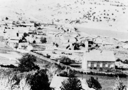
The BC Archives caption for this photo say simply "Lillooet", and features St. Mary's church in the foreground (where the Lillooet Museum is today) but in reality and despite its poor resolution it gives one of the best views of Chinatown in its peak during the 1890s. The larger buildings at extreme far left are stores and other commercial buildings lining Main Street or on the alley behind it, many of them Chinese-owned. Everything to the right of them - nearly everything visible other than St. Mary's - is Chinatown, and as you can see it was a very large Chinatown indeed - probably Lillooet town's largest at the time, with a near-urban density of housing not seen again until after World War II, and really not even since then. |
|
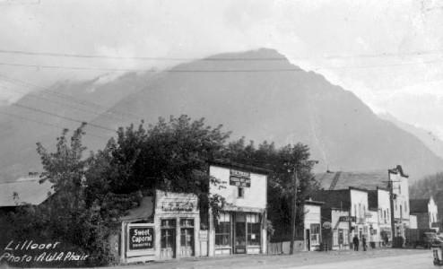 BC Archives #C-01246 photto Artie Phair 1930s 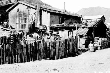 BC Archives # A-04281 Chinatown was in an area most locals now call VLA Flats, after the Veterans' Land Authority which displaced the dwellings and market gardens of the historic old Chinese community, and re-allocated the land to returning war veterans after World War II. Chinatown also included the back "alley" which runs between Main Street along the BCR tracks. After World War II, many of the Japanese internee families who decided to stay in Lillooet wound up living in this same area (between Main Street and the tracks), notably the Yada family, who remained in the grocery business locally until recently (?) with a home on the alley behind their Main Street grocery-cum-department store. |
Like
many frontier-era towns in BC's wild Interior, Lillooet had its own
Chinatown, dating back (like the town itself) to the Fraser River Gold
rush of 1858.
Unofficial census figures for 1862, when
Lillooet's initial heyday during the Fraser Canyon Gold Rush were over,
and most prospectors had headed north for the booming Cariboo Gold Rush
around Barkerville, show that the Chinese were the largest part of the
non-native community in Lillooet at the time. the photo above of
the part of the Golden MIle is actually illustrative of the Chinese
community as perhaps over half of the storefront shown were
Chinese-owned or staffed. The largest building with the peaked
false front is that of Wo Hing inc. Compiled by Port Douglas Magistrate J. Boles-Gaggin for the town of Lillooet show 97 Chinese, 44 US citizens, 33 British subjects and 20 Mexicans; native people in the town of Lillooet at the time numbered roughly 700, but this figure likely does not include native people not living "in town". During the height of the Fraser Canyon Gold Rush (fall of '58 through to '61 or so) all these figures can be expected to be multiplied a few times; during the 1880s and 1890s and through until the 1920s, the Chinese population in Lillooet and along the Cayoosh Creek goldfields and elsewhere in the region boomed, numbering in the several hundreds, perhaps well over one thousand. |
|
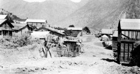
BC Archives # E-06947
| Chinatown
was located just behind and below the Golden
Mile on the slope and benchland between Main Street and the Fraser,
and from there extended along a hilly not-quite-benchland area towards
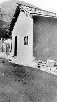
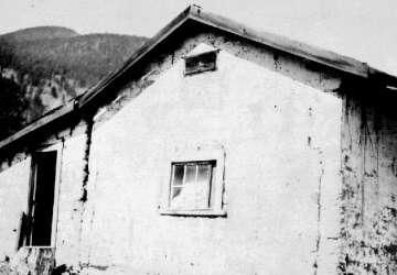
the Old Bridge. It was in Chinatown that most of Lillooet's adobe houses were mostly located, suggesting that the Mexican packers who brought the technique north with them must have lived among the Chinese and other non-whites among the gold rush populations - it seems probable that the Chinese adopted the Mexican construction techniques, which aren't that different from ordinary clay/mud or brickwork as is common in traditional Chinese peasant construction, but more likely they took over homes built by their original Mexican builders. Some of the BC Archives pictures here are of the same houses but separate images of them are catalogued under "Adobe Houses" but also under "Lillooet Chinatown". Not only Chinese and Mexicans chose adobe for building materials, though - the house below at left, shown under construction and completed, was the residence of the Russell family. I'm not sure of its location - between Chinatown and the Old Bridge I think. |
More Adobe Houses
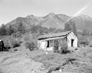 BC Archives # I-29070 BC Archives # I-29070 |
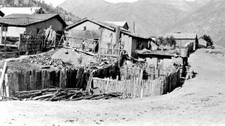 BC Archives # H-01008 BC Archives # H-01008 |
 BC Archives # H-01007 |
 BC Archives # A-03539 |
|