
BC Archives # B-04968
| In support of my webspace rental fees pllease donate generously at GoFundMe or Patreon |
Thank your for visiting.
If you enjoy this site please make a donation. |
|
| The beauty of the country around Lytton is not well-seen from the main highway, or even the rail lines despite their closeup of the canyon gorge and waters. Hikes into the high country in the area - or drives on the many backroads which are hidden within the surrounding wilderness - reveal an area of some grandeur beyond the scope of the ordinary highway traveller. The landscape around Lytton has incredible depth of contour, and variety of terrain and climate. Not as spectularly ornate as the gorges of the Lillooet Country, the mountains and canyons that converge on Lytton invoke a classic incarnation of the Old West's themes of sagebrush, pine, and canyon, flanked by alpine mountains and meadows as grand as any on the continent. For travellers with a bit of spare time and a suitable chassis, or just good hiking legs, the heights and backroads around Lytton afford spectacular views - and relief from the scorching heat that typifies Lytton's extremely arid local climate. Touting itself as "Canada's Hot Spot, Lytton sure enough registers the highest summer temperatures in the country (disputed by Lillooet, which is often hotter but doesn't have a federal weather station). Hikers are advised to carry plenty of water as well as a good appreciation of the potential dangers posed by wildlife - notably the timber rattler, which is relatively common in the area. | |
| The view at right is along the old TransCanada Highway in the vicinity of the Fraser Canyon Airport, a small-craft field about 10 miles south of town; on the other hand the terrain resembles the more rugged country up towards Spences Bridge, so if any locals recognize the bluffs in the background I'd appreciate the correction (the BC Archives caption says "Cariboo Highway near Lytton"). | 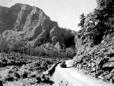 BC Archives # G-04130 (A. Curtis Photo) |
 BC Archives # D-02631 (1954, photo BC Gov) |
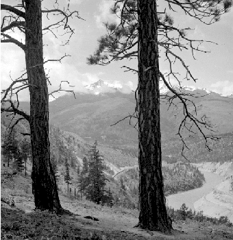
The west side of the Fraser opposite town runs as one mountain wall from Hope to Lillooet, pierced here and there by creeks large enough to tear a hole in the range's flank. The view at left shows the peaks of the Lillooet Range, including the highest peak in the area, Mt. Skihist (2925m, or 9759'), which also forms one of the main gatepeaks of the Stein Valley. The Stein River (Stgayn in Nlakapamux; the modern name is actually an anglicization of a native name) is the largest of these; its mouth is just north of Lytton; the entire Stein basin has been preserved as the Stein Valley Nlaka'pamux Heritage Park, for which Lytton serves as the main access/entry point. |