| Webspace generously donated
by synercom/edi |
Thank your for visiting.
If you enjoy this site please make a donation. |
|
| The higher profile of areas upriver from
Moran in gold rush times is a reminder that only wheeled travel - wagons
and stages - needed to use the road, and that non-wheeled travel could
use the Canyon route instead and many did; it was shorter but much more
scarce on water and the system of roadhouses available along the Cariboo
Road, however.. |
|
 BC Archives I-57565 |
|
| The building at left was Phil
Grinder's hotel and post office and dates from the time when the Canyon
trails were still a major route of travel between Lillooet and the
Cariboo.and Big Bar was a relatively busy place. The picture at
right is typical of the rangeland valleys which cut into the Cariboo
plateau in the Big Bar area. |
|
 Aerial pic from Photos by Kat |
 Aerial pic from Photos by Kat |
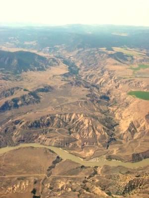
| I'm uncertain of the location
depicted here, which is somewhere between Moran and Dog Creek; I think
it's south of Big Bar as there are still mountains flanking the canyon
instead of plateau. |
|
 Aerial pic from Photos by Kat |
|
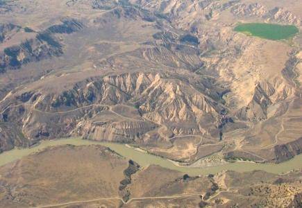
Churn Creek Canyon |
|
 Aerial pic from Photos by Kat Photo by Kat |
 BC Archives # I-57593 |
The Churn Creek
Protected Area  |
 BC Archives # B-02676 |
| |
 Aerial pic from Photos by Kat |
 Aerial pic from Photos by Kat |
 Aerial pic from Photos by Kat |
| |
|
| |
|
| |
|
 Aerial pic from Photos by Kat |
|
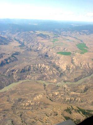
| This picture is of, I think, Lone Cabin Creek,
which is in between Moran and Churn Creek. |
|
 Aerial pic from Photos by Kat |
 Aerial pic from Photos by Kat |
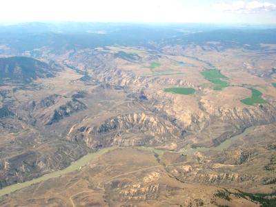
Dog Creek & Gang Ranch |
|
 Aerial pic from Photos by Kat |
The tiny suspension span in the foreground
of this picture is the Dog Creek Bridge, the only Royal Engineers'
Bridge across the Fraser still in use. Other similar bridges were
at Alexandra (near Yale), Lillooet, Riske Creek (near Williams Lake) and
Soda Creek, at the northern perimeter of the Cariboo district north of
Quesnel. The Dog Creek Bridge connects the ranches of the
western Cariboo plateau to the sprawling rangelands of the eastern
Chilcotin plateau and the famous Gang Ranch, once the world's largest
(a title now held by the Douglas Lake Ranchy based near Merritt).
Other river crossings of the river were by cable ("friction"
ferries, as at Pavilion) or by aerial
ferry, some still in operation (High Bar, Lytton). The old
aerial auto ferry at Boston Bar, which connected the large
community of North Bend to the outside world, has in recent years been
replaced by a modern bridge, as has the old suspension crossing of
the Fraser from Williams Lake to the Chilcotin at Riske Creek.
Dirt roads run the length of the canyon on both sides - or close
to it, as the difficulty of the terrain and the purpose of the roads
often lead them onto the plateaux and mountains above. |
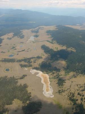
Alkali Lakes |
 Aerial pic from Photos by Kat |
 Aerial pic from Photos by Kat |
 Aerial pic from Photos by Kat |
Jesmond |
|
 Aerial pic from Photos by Kat |
 Aerial pic from Photos by Kat |
 Aerial pic from Photos by Kat |
 Aerial pic from Photos by Kat |
 Aerial pic from Photos by Kat |